


Erbacherhof
Farm holiday in Bozen
Fam. Plattner Rentscherstr. 28/A
M +39 342 7776381 info@erbacher.it
4 holiday flats: 2-4 persons, 2-6 persons
Our guests love …
- relax in the midst of vineyards with a view of the Rosengarten
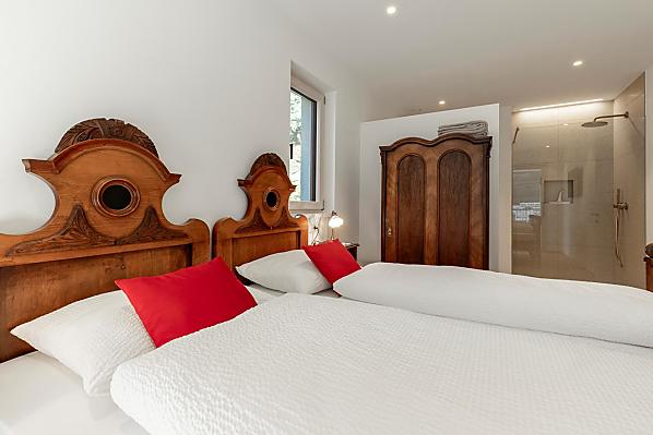
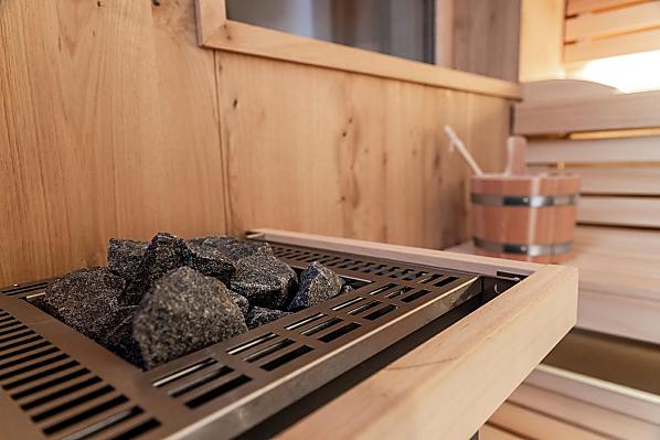
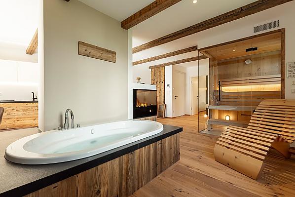
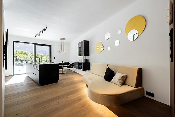
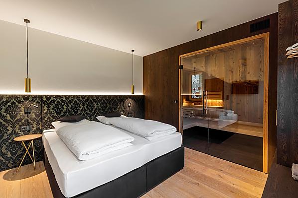
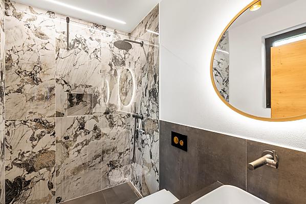
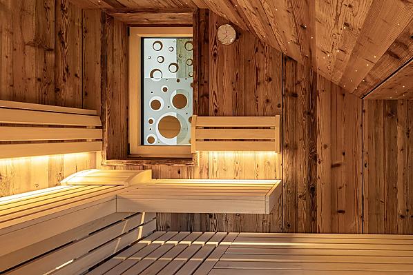
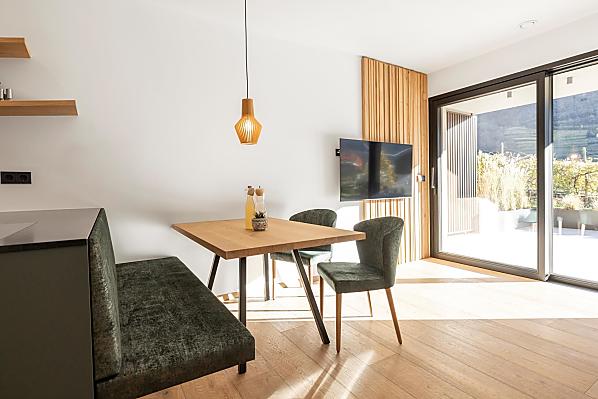
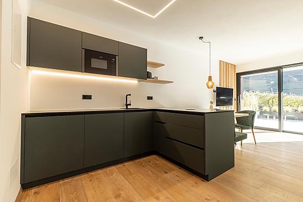
- Modern apartments with private sauna and pool
- Living nature!
Farm with Fruit growing
Board: breakfast
Farm's own products:
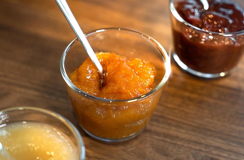
eggs, fruit jams, cordial, fruit juice, wine ...
Farm offers:
Experience everyday life on the farm, Farm tour and produce tasting
Our guests love …
- relax in the midst of vineyards with a view of the Rosengarten
- Modern apartments with private sauna and pool
- Living nature!


The farm
A place to relax, experience and learn.
Stay in the midst of vineyards in Bozen-Rentsch.
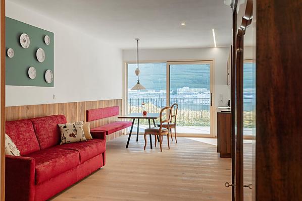
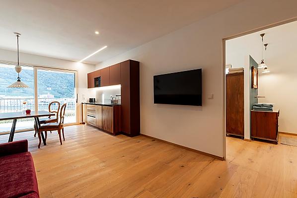
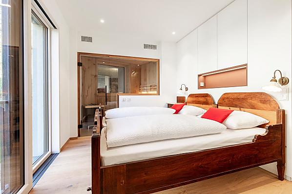
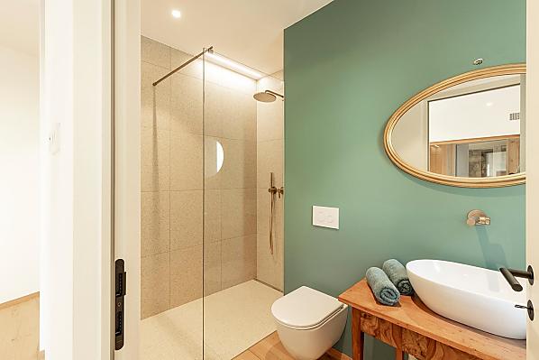
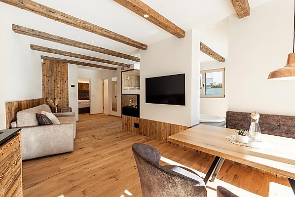
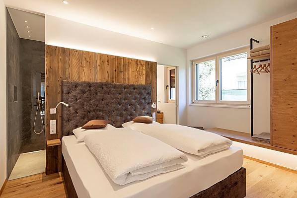
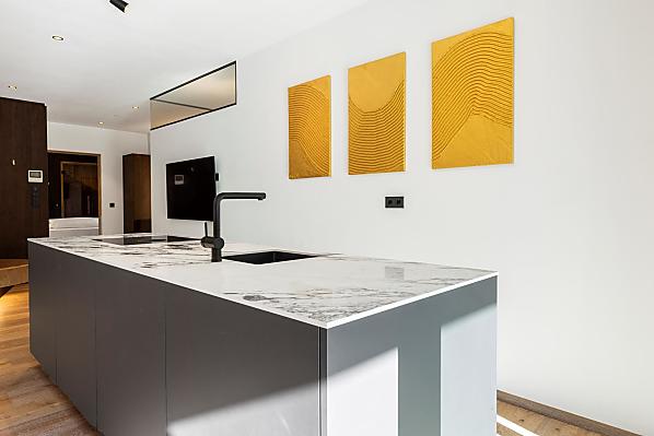
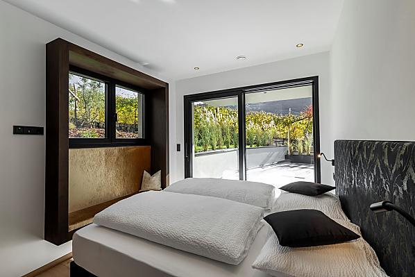
New, modern holiday flats with private sauna and jacuzzi await you, as well as a magnificent view of the Rosengarten mountains.
The pool in the garden provides a refreshing dip. Life on the farm takes place all around the farm, and we are happy to share this with our guests.
The central location makes our holiday flats in Bozen-Rentsch the ideal base for leisure activities and excursions into the countryside.
Stay in the midst of vineyards in Bozen-Rentsch.
New, modern holiday flats with private sauna and jacuzzi await you, as well as a magnificent view of the Rosengarten mountains.
The pool in the garden provides a refreshing dip. Life on the farm takes place all around the farm, and we are happy to share this with our guests.
The central location makes our holiday flats in Bozen-Rentsch the ideal base for leisure activities and excursions into the countryside.
Daily life on the farm
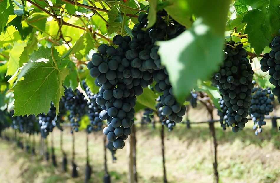
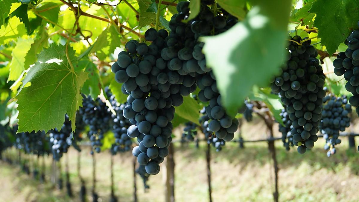
The Erbacherhof is a farm with Fruit growing and Wine growing
- apple growing (FujiGranny SmithPink LadyRoyal Gala)
- Wine growing (Lagreinvernatsch)
These animals live on the farm all year-round
dog
dog
Things to do on the farm
Farm activities
- Experience everyday life on the farm
- Farm tour and produce tasting
- Farm garden tour
- Orchard and vineyard tours
- Cellar tour
- guests can take from the farm garden
For your health and well-being
- Finnish sauna
- gym
- Jacuzzi
- Turkish bath
Leisure activities
- Entertainment evenings
Summer leisure activities
- Bike hire
We speak German, Italian and English
Holiday flat from 290€ a night
Moments of indulgence at Erbacherhof
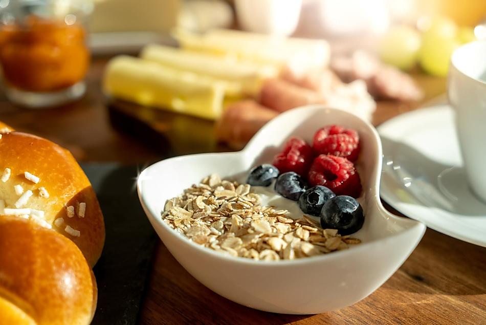

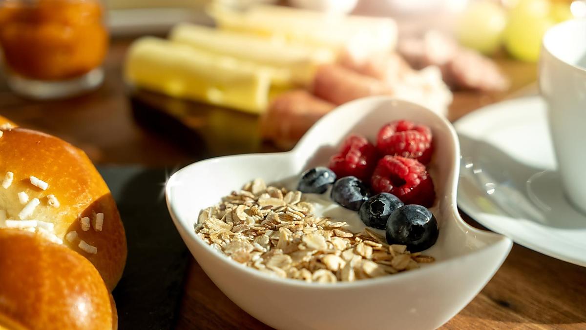
Breakfast
- Breakfast basket
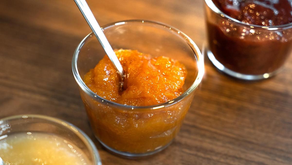
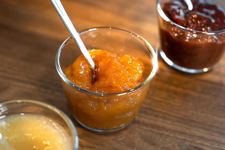
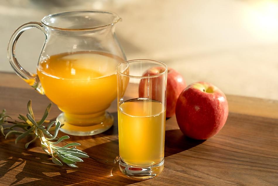
- Farm's own products at breakfast: eggs, fruit jams, cordial, fruit juice, baked goods, fresh fruit in season
Farm's own products
- eggs (free-range eggs)
- fruit jams (apple jam, damson jam, peach jam)
- cordial (balm cordial, elderflower cordial)
- fruit juice (apple juice (unfiltered/naturally cloudy))
- wine (Select wine DOC)
- fresh fruit in season (apples, grapes)
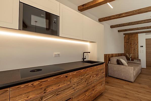
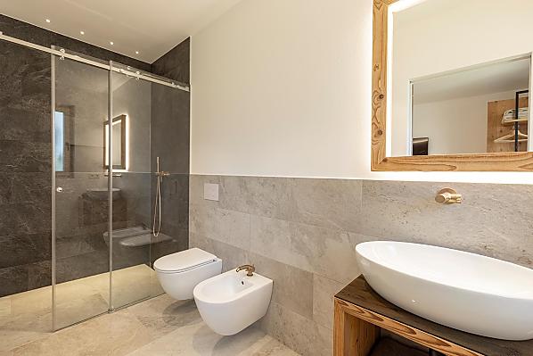
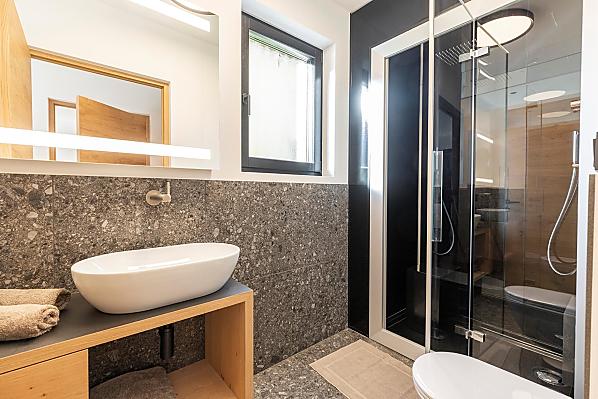
Accommodation & prices
All of our accommodation includes
Outside area
- lawn for sunbathing etc.
- Herb garden
- pergola
- outdoor saltwater pool
Eco-friendly holiday
- Geothermal energy
- Photovoltaic system
- E-bike charging station
- Electric car charging station
Communal indoor area
- common room (wooden floor, WiFi, Internet access, games, television, satellite TV, books, kitchenette, fridge)
- Bicycle storage room
- Product tasting room
- Storage room
- Wine cellar
Other services & facilities
- allergy friendly
- Wi-Fi
- packed lunches
- covered parking
- garage
- pick-up service from bus or train station
- laundry room
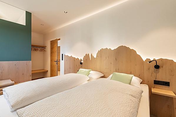
Holiday flat Renate
2-6 persons (4 fixed beds) 65m²
from 290€ for 2 adults
Pets are not allowed in this holiday flat


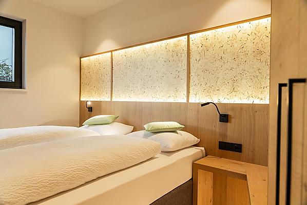
Holiday flat Greti
2-4 persons (2 fixed beds) 61m²
from 290€ for 2 adults
Pets are not allowed in this holiday flat


Holiday flat Gabi
2-4 persons (4 fixed beds) 69m²
from 290€ for 2 adults
Pets are not allowed in this holiday flat


Holiday flat Anna
2-6 persons (4 fixed beds) 60m²
from 290€ for 2 adults
Pets are not allowed in this holiday flat


Location & arrival
Nearby
- distance to village centre1.6 km
- distance to ski slopes30.7 km
- distance to bathing lake20 km
- distance to cycle path1.2 km
- distance to bus stop100 m
- distance to shops100 m
Activities nearby
School Museum Bolzano
180 m
S. Maddalena hill
733 m
Südtirol Rad
1,2 km
St. John's Church
1,5 km
Piazza Municipio / Rathausplatz
1,6 km
Railway Station Square
1,6 km
Piazza del Grano a Bolzano/Kornplatz in Bozen
1,6 km
Weighing House
1,6 km
South Tyrol Museum of Natural History
1,7 km
Bozen
1,7 km


Further farms
Still looking?
You're sure to find your dream holiday farm from amongst more than 1,600 holiday farms all over South Tyrol.